Melbourne Train Map 2026: Lines, Tickets & Fares
Last updated: 18 July 2026

Last updated: 18 July 2026
Melbourne train service updates
Check Transport Victoria’s Journey Planner before travelling. Its live data can show departures, delays, timetable changes, planned works and platform information.
The Metro Tunnel changed how the Melbourne train network works. Since 1 February 2026, Sunbury, Cranbourne and Pakenham services have used a new five-station underground route instead of the City Loop.
The phrase Melbourne metro map is common, but the accurate description is a metropolitan suburban or commuter railway. Metro appears here in the proper names Metro Trains Melbourne and Metro Tunnel, not as the system type.
Metro Trains Melbourne reports 16 lines, 227 stations, 269 trains and more than 1,000 km of track. The length is track km, not passenger route km. Transport Victoria recorded 185.2 million estimated metropolitan train boardings in calendar 2025, including a 5% transfer uplift.
Contents
Metro Trains Melbourne is owned by a consortium comprising MTR Corporation at 60%, John Holland at 20% and UGL Rail at 20%. The operator describes its role as operating and maintaining Melbourne’s metropolitan rail service.
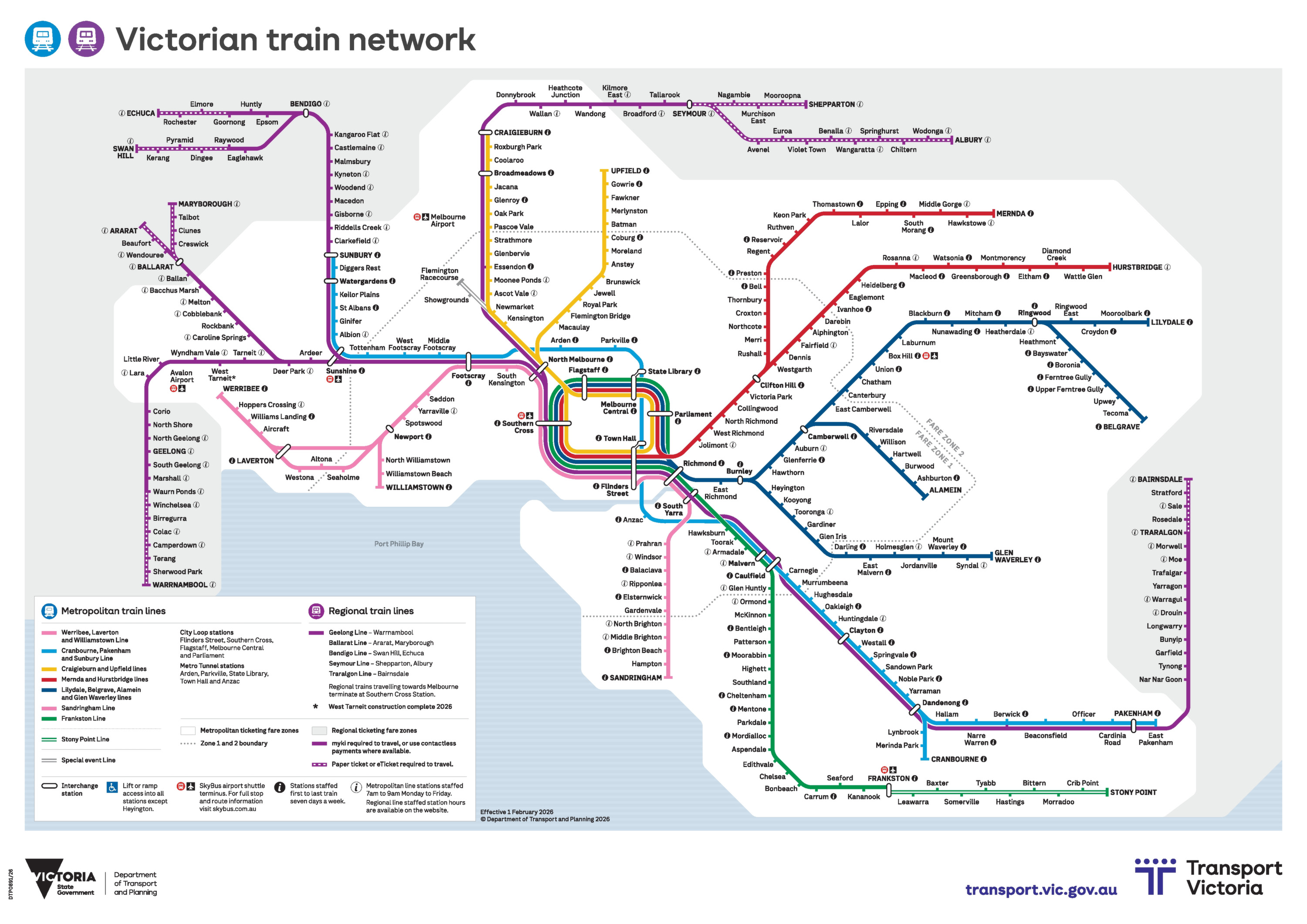
The official Melbourne train network map effective from 1 February 2026 includes the integrated Metro Tunnel service pattern. It should be used as an orientation layer, with the current Journey Planner or line timetable confirming the exact service for the day.
The network has 16 lines. The colour words below describe visible map swatches; Transport Victoria does not publish them as formal colour names.
The grey Flemington Racecourse and Showgrounds branch is a special-event line, not a seventeenth regular line.
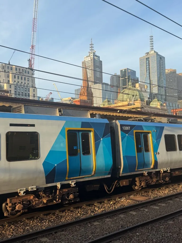
City Loop stops can differ by line, service and time. Frankston trains currently run all day via Parliament, Melbourne Central, Flagstaff and Southern Cross to Flinders Street. State Library connects underground to Melbourne Central and Town Hall connects to Flinders Street. Each transfer takes about four minutes, with no tap off or tap on between the paired stations.
Timetabled passenger service began on 30 November 2025 under a staged timetable. Full integration followed on 1 February 2026, when all Sunbury, Cranbourne and Pakenham trains began using the twin 9 km tunnels and five underground stations: Arden, Parkville, State Library, Town Hall and Anzac.
Sunbury trains no longer serve North Melbourne or the City Loop. Cranbourne and Pakenham trains no longer serve Armadale, Toorak, Hawksburn, South Yarra, Richmond or the City Loop. Passengers for the central legacy stations can use the State Library or Town Hall underground connections.
The zoomable map at the top of this page is the full Melbourne train network map, effective 1 February 2026 and already including the Metro Tunnel route. View it directly in the viewer above or save it with the PDF Download button. That is the map to use for whole-network orientation.
Beyond that full map, the operator also publishes niche versions: line-group change maps that explain individual post-tunnel routes, the Big Build project map for the tunnel and its five stations, and V/Line’s directory for regional travel outside metropolitan Melbourne. For everyday city trips, the map above plus current timetable information is all you need.
Visitors can use suburban trains for many cross-city journeys, but the correct arrival station and final walk, tram or bus connection must be checked individually. Southern Cross is the rail interchange for the SkyBus airport connection.
In the 12 months ending December 2025, Melbourne received 3.5 million overnight interstate leisure visitors, who stayed 13 million nights and spent A$5.9 billion, according to Visit Victoria using Tourism Research Australia data.
The two new central underground interchanges are particularly useful: State Library links to Melbourne Central, while Town Hall links to Flinders Street. No tap off or tap on is required within either paired transfer.
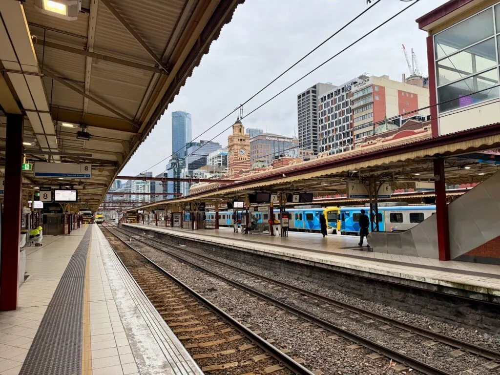
The destination matrix pairs each sight with a train line and station. It also flags final walks and transfers that a schematic map cannot show.
| Destination | Train line | Station | Practical tip |
|---|---|---|---|
| Federation Square | Cranbourne, Pakenham and Sunbury lines | Town Hall | Use the Swanston Street entrance near Young and Jackson Hotel; Transport Victoria names Federation Square as a destination served from Town Hall. |
| Queen Victoria Market | Cranbourne, Pakenham and Sunbury lines | State Library | State Library is the direct Metro Tunnel option. The market is minutes from the station; check the Journey Planner during precinct works. |
| State Library Victoria | Cranbourne, Pakenham and Sunbury lines | State Library | The library says State Library and Melbourne Central stations are right at its doorstep. |
| Melbourne Cricket Ground | Hurstbridge or Mernda Line | Jolimont | Walk about five minutes or 350 m through Yarra Park to Gate 2. Cranbourne, Pakenham and Sunbury trains no longer stop at Richmond. |
| Docklands and Marvel Stadium | Frankston Line | Southern Cross | Walk across the Bourke Street pedestrian bridge. Cranbourne, Pakenham and Sunbury passengers must change because their line does not serve Southern Cross. |
| Shrine of Remembrance | Cranbourne, Pakenham and Sunbury lines | Anzac | Use Domain Road Exit 4, then follow the path through the Shrine Reserve; the memorial is about 300 m from the station. |
| University of Melbourne, Parkville campus | Cranbourne, Pakenham and Sunbury lines | Parkville | Use Grattan Street East, located outside the University of Melbourne, for direct train access to the Parkville campus. |
| Melbourne Museum | Frankston Line | Parliament | Allow about 15 minutes to walk from Parliament. The station has lift access to the top of Lonsdale Street. |
Transport Victoria confirms that Victorian public transport fares are temporarily half price from 1 June 2026 until 1 January 2027. The discount covers trains, trams, buses and subsidised regional services, but not SkyBus, ferries or non-subsidised regional buses.
The current fare table lists a Zone 1+2 full fare of A$2.85 for two hours and a daily cap of A$5.70. AUD is the charged currency. Approximate USD values use the Reserve Bank of Australia rate of 1 AUD to 0.6980 USD on 17 July 2026.
A physical myki is available online, at authorised outlets including 7-Eleven stores within the myki boundary, selected machines, staffed stations and the PTV Hub. It cannot be bought or topped up on a tram or bus.
Train passengers using myki must tap on and off. A missed tap-off can trigger a default fare. Mobile myki is an Android product in Google Wallet and is separate from ordinary bank-card contactless payment.
| Ticket | Price | Buy ticket |
|---|---|---|
| Full fare myki Money, 2-hour Zone 1+2 | A$2.85 (≈ US$1.99) | Buy a myki |
| Full fare myki Money, daily Zone 1+2 | A$5.70 (≈ US$3.98) | Buy a myki |
| Full fare weekend or public holiday cap | A$4.00 (≈ US$2.79) | Buy a myki |
| Eligible concession, 2-hour Zone 1+2 | A$1.42 (≈ US$0.99) | Buy a myki |
| Eligible concession, daily Zone 1+2 | A$2.85 (≈ US$1.99) | Buy a myki |
| Eligible concession, weekend or public holiday cap | A$2.00 (≈ US$1.40) | Buy a myki |
Fares checked 18 July 2026. Temporary half-price fares run until 1 January 2027. USD conversions use the RBA rate published for 17 July 2026 and are approximate.
There is no verified universal first-train, last-train or frequency rule for the whole network. Use the official timetable finder or Journey Planner because times vary by line, station, day and planned works.
Verified peak examples are corridor-specific: Cranbourne and Pakenham can run every 4.5 minutes, Sunbury every 5 to 10 minutes, and Frankston every five minutes or better under its timetable from 21 May 2026.
Night Trains run through Friday and Saturday nights, approximately every 60 minutes on every line except Stony Point and Flemington Racecourse. After 1:00 am, they operate directly to and from Flinders Street and Town Hall.
Several central stations close shortly after midnight, including Anzac, Arden, Flagstaff, Melbourne Central, Parkville, Parliament and State Library. Southern Cross closes shortly after 1:00 am, so the overnight map differs from normal daytime routing.
Four outer shuttles complete the official overnight pattern: Ringwood to Belgrave or Lilydale, Newport to Williamstown, Camberwell to Alamein, and Dandenong to Cranbourne. Check the current Night Train information before departure.
As of 18 July 2026, full-fare customers can use eligible Visa or Mastercard cards and compatible devices at every myki-enabled train station and on every tram. Bus rollout starts on 19 July and is scheduled to reach all myki-enabled buses from 26 July. Until acceptance is confirmed on a bus, look for the Visa or Mastercard symbol on its reader.
Melbourne Airport Rail is not a usable airport connection in 2026. Stage 1, the West Footscray-Albion Rail Upgrade, is underway and scheduled for completion in 2030, but it does not reach the airport. Dedicated airport tracks and the Airport and Keilor East stations remain future stages under planning.
The Australian Government project register expects construction to be completed in late 2033. This is an expected project horizon, not a confirmed passenger opening date. SkyBus remains the direct public transport link between Tullamarine and Southern Cross in 2026.
Suburban Rail Loop East from Cheltenham to Box Hill is under construction, tunnelling starts in 2026, and trains are planned for 2035. It is a future railway, not part of the Melbourne train map visitors can use in 2026.
Fun Fact: Yarra Trams describes Melbourne as the world’s largest operational tram network. That superlative refers to the tram system, not the Melbourne train network shown on this page.
Use the PDF viewer and PDF Download button at the top of this page. The official Victorian train network map took effect on 1 February 2026 and includes the Metro Tunnel route through Arden, Parkville, State Library, Town Hall and Anzac.
Melbourne is best described as a metropolitan suburban or commuter railway. Metro Trains Melbourne reports 16 lines and 227 stations. The operator lists consortium ownership as MTR Corporation 60%, John Holland 20% and UGL Rail 20%.
No. Tullamarine has no train connection to the city as of 18 July 2026. SkyBus serves Terminals 1, 3 and 4 and Southern Cross from 4:00 am to 1:00 am daily. Allow about 30 minutes in normal conditions, with services roughly every 10 to 15 minutes. myki is not valid. Melbourne Airport Rail has an expected construction horizon in late 2033, not a confirmed passenger opening date.
Train passengers can use myki and must tap on and off. Eligible full-fare customers can also use accepted Visa or Mastercard cards and compatible devices at every myki-enabled train station. The Free Tram Zone applies only to tram trips made entirely inside its CBD and Docklands boundary and does not make train travel free.
Night Trains operate through Friday and Saturday nights on all lines except Stony Point and Flemington Racecourse, generally about every 60 minutes. Central station closures and outer shuttle patterns mean travellers should check the current overnight map before departure.
You might also be interested in these metro maps – for comparison or for your next trip: