Newcastle Metro Map 2026: Lines, Tickets & Fares
Last updated: 20 July 2026

Last updated: 20 July 2026
Current Newcastle Metro disruption information
Regent Centre and Airport: Works include weekday evening closures from 20 July 2026 and a closure between South Gosforth and Airport from 15 to 23 August 2026. Temporary replacement buses are not Metro services.
Check current service status and review the planned-work details before travelling.
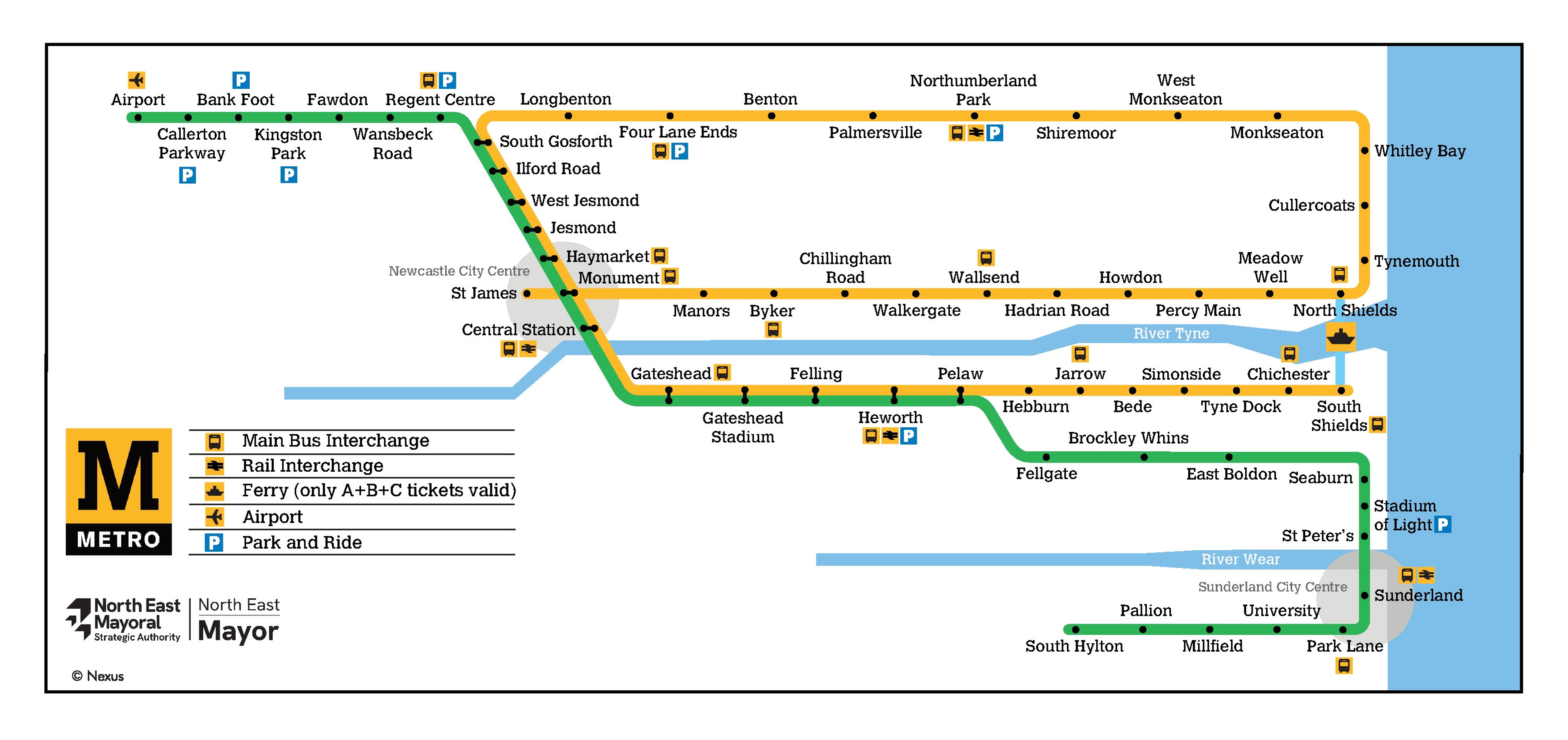
The Tyne and Wear Metro links central Newcastle with Gateshead, Sunderland, the North Tyneside coast and Newcastle International Airport. The embedded main map is the primary guide for ordinary journeys; use the fare-zone map only when comparing tickets and the Metro and local rail map for Northumberland Line connections.
Map symbols also mark bus, ferry and rail connections. These are not part of the 60-station Metro network.
Contents
The two-line Tyne and Wear Metro carries visitors through Newcastle and Gateshead towards Sunderland or the North Tyneside coast. It includes a station beside an international airport terminal, while its city-centre tunnels connect with surface and reused railway sections.
The Tyne and Wear Metro opened to passengers in August 1980. Nexus operates it as a public light-rail rapid-transit system with above-ground and underground sections.
At 31 March 2025, the network covered 48.5 route miles (about 78 km) and 60 stops. In the year ending March 2025, it recorded 32.2 million passenger journeys, 4.9% more than the previous year.
Metro reused local railway alignments from its opening, and the 2002 Sunderland extension shares national-rail infrastructure before continuing to the Metro-only section toward South Hylton. That hybrid engineering does not change the system’s official Metro identity.
The Tyne and Wear Metro’s 60-station operating total excludes buses, Shields Ferry, Northern local rail and proposed projects. The Washington route therefore does not belong on the current Newcastle Metro map or in the 60-station count.
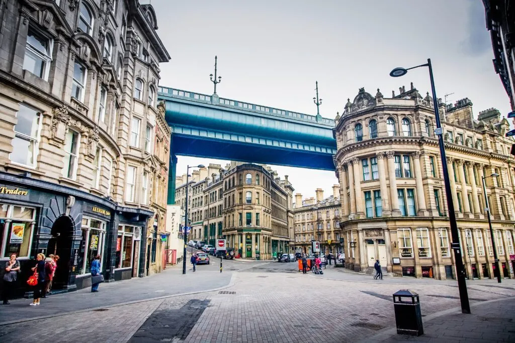
The Yellow and Green lines both serve Haymarket, Monument, Central Station and Gateshead. They diverge north of South Gosforth and south of Pelaw. Monument has four platforms for interchange between its north-south and east-west platform groups.
Follow the line colour to the destination, check the terminus shown on the train, then confirm any change at a shared central station. Use the separate fare-zone map to count the zones crossed before buying a ticket.
| Map version | Best for | Coverage | View map |
|---|---|---|---|
| Current official main map | General journeys | All 60 operating Metro stations plus clearly marked connections | View PDF |
| Current official fare-zone map | Choosing PAYG, single, day or season-ticket zones | Metro fare zones A to C | View zone PDF |
| Current official Metro and local rail map | Connections with Northern services | The Metro network and separately labelled Northumberland and Sunderland rail services, including Northumberland Line zone D. | View rail PDF |
| Current official student fare-zone map | Choosing a Metro Student Season Ticket | Student fare-zone selection | View student PDF |
To use the Newcastle Metro map, match each destination with its line and station, then check fare zones and live service information.
In central Newcastle, Haymarket suits the Great North Museum, Monument serves Grey Street, Central Station connects with mainline trains, and St James sits below the football stadium.
Central Station Metro is below and within the Newcastle railway station complex, so no street transfer to another Metro stop is required. Life Science Centre is a short walk away.
Newcastle International Airport, code NCL, has its own Green Line terminus named Airport beside the terminal.
Regular daytime Green Line journeys from Airport take 24 minutes to Monument and 26 minutes to Central Station.
All stations have access by a level route, ramp or lift, but platform gaps and step dimensions vary. Travellers who need assistance can review current access information and book help at least four hours ahead on 0191 203 3666.
| Destination | Line | Station | Practical tip |
|---|---|---|---|
| Newcastle International Airport | Green | Airport | The station is adjacent to the terminal; allow 26 minutes to Central Station in the regular daytime timetable. |
| Newcastle railway station | Yellow and Green | Central Station | The Metro platforms are below the mainline station complex. |
| Grey's Monument, Grey Street and Theatre Royal | Yellow and Green | Monument | Theatre Royal is a short walk from Monument station. |
| Great North Museum | Yellow and Green | Haymarket | The museum is a short walk from Haymarket station. |
| St James' Park | Yellow | St James | The dedicated stop is below the football stadium. |
| BALTIC Centre for Contemporary Art | Yellow and Green, then bus | Gateshead | BALTIC is not directly served by Metro; check the current journey planner for the onward trip from Gateshead. |
| Sunderland Museum and Winter Gardens | Green | Sunderland | The museum is near Sunderland station. |
| Tynemouth Market and coast | Yellow | Tynemouth | The market is inside the station on the coastal route. |
| Life Science Centre | Yellow and Green | Central Station | The venue is a short walk from Central Station. |
The destinations table pairs major visitor sights with the correct line and station. BALTIC is not directly served by Metro; check the current journey planner for the onward trip from Gateshead.
Check the platform direction before boarding, especially at Monument, where the Yellow Line serves different platform groups around its loop. Passengers requiring assistance should arrange help in advance and allow extra time for station-specific platform gaps.
Adult Metro fares cover zones A, B and C. Pop Pay As You Go charges each journey until the applicable daily cap is reached. Zone D belongs to the Northumberland Line and is relevant only if a combined PAYG journey includes that railway. For Metro-only journeys across zones A to C, current Pop PAYG prices are lower than the equivalent adult paper single and day-ticket fares.
Prices below are effective from April 2026. The converted USD amounts use the 16 July 2026 exchange rate of GBP 1 = USD 1.3489 and are rounded to two decimal places.
| Ticket | Price | Buy ticket |
|---|---|---|
| Pop PAYG, one zone | GBP 2.20 single (approx. USD 2.97); GBP 3.30 daily cap (approx. USD 4.45) | Buy from Nexus or load the Pop app for Android or iOS |
| Pop PAYG, two adjacent zones | GBP 2.50 single (approx. USD 3.37); GBP 4.50 daily cap (approx. USD 6.07) | Buy from Nexus or load the Pop app for Android or iOS |
| Pop PAYG, three Metro zones; four zones only with Northumberland Line zone D | GBP 2.50 single (approx. USD 3.37); GBP 5.00 daily cap (approx. USD 6.74) | Buy from Nexus or load the Pop app for Android or iOS |
| Paper Metro Single | One zone GBP 3.20 (approx. USD 4.32); two zones GBP 4.30 (approx. USD 5.80); all Metro zones A to C GBP 5.10 (approx. USD 6.88) | Available at station machines |
| Paper Metro Day Ticket | One zone GBP 4.80 (approx. USD 6.47); two zones GBP 6.10 (approx. USD 8.23); all Metro zones A to C GBP 7.00 (approx. USD 9.44) | Available at station machines |
| Pop Blue, ages 16 to 21 | GBP 1.00 single (approx. USD 1.35); GBP 2.20 for all-day travel (approx. USD 2.97) | Check eligibility |
| Child Day Ticket, ages 5 to 15 without Under 16 Pop | GBP 2.20 (approx. USD 2.97) | Available at station machines |
A physical Pop PAYG card is free with a required starting balance of GBP 5.00 (approx. USD 6.74).
Top up the physical Pop card online or at a station machine, then touch in and out for every trip, including when a gate is open.
Paper singles are valid for 90 minutes from purchase for one non-return journey. Paper day tickets allow unlimited same-day Metro travel within the purchased zones. Keep the ticket for barriers and inspections.
Android users can create a separate virtual Pop PAYG card in Google Wallet. Nexus offers the Pop App for Android and iPhone via Google Play and the App Store.
For passengers aged 16 to 21, current eligibility details are available from the official Pop Blue page.
The Metro does not operate 24 hours. First and last trains vary by station, direction, day and final destination.
The timetable lists the first Airport departures towards Newcastle at 05:38 on weekdays, 05:37 on Saturday and 06:14 on Sunday. The last Airport departure continuing through central Newcastle is 23:07 daily; later listed trains terminate at Regent Centre.
Services typically run about every 12 minutes per line or branch on Monday to Saturday daytimes and every 15 minutes in the evening. Early Sunday service is about every 30 minutes per branch before frequencies increase to about every 15 minutes.
Alternating Yellow and Green trains serve the shared central corridor about every six minutes during the day. This interval does not apply to every station or branch. Use Timetable information for the selected stop.
Replacement buses run for specific engineering closures. They are temporary bus services, not Metro lines or a standing night service.
The Tyne and Wear Metro is changing to its new train fleet. All 46 Stadler Class 555 trains had been delivered by 21 February 2026. By 2 June 2026, almost all daily services used the new trains.
All 46 are intended to be available for passenger service by the end of 2026. The last guaranteed Class 599 passenger runs were scheduled for 22 to 26 June, although occasional later appearances remained possible.
Metro to Washington remains a planned 13 km extension from Pelaw through Washington to South Hylton. Its proposed stations are Follingsby, Washington North and Washington South, with details still undecided.
The proposed extension could open by 2033, but the outline business case and final funding are not yet complete.
The current network began carrying passengers between Haymarket and North Shields in August 1980. The original network was completed in 1984, Airport opened in 1991, and passenger service to Sunderland and South Hylton began on 31 March 2002.
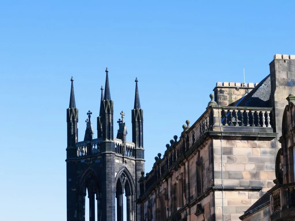
Fun Fact: Grey’s Monument stood on foundations only eight feet deep. Before tunnelling beneath it, Metro engineers installed special piles to strengthen the monument’s plinth.
You might also be interested in these metro maps – for comparison or for your next trip:
Yellow Line trains connect central Newcastle with St James, the North Tyneside coast and South Shields. Green Line trains connect the centre with Airport, Gateshead, Sunderland and South Hylton. Both lines share central stations before diverging.
Buy a paper ticket at a station machine or use Pop PAYG. Touch a physical Pop card or an Android virtual Pop card in and out on every journey.
No. The Tyne and Wear Metro is not open 24 hours. Times depend on the station, direction, day and destination, and late trains may terminate before the end of the line.
Central Station Metro is below and within Newcastle’s mainline railway station complex. Passengers can transfer inside the station area rather than walking to a different Metro stop.
Take a Green Line train from Airport station. Regular daytime journeys take 24 minutes to Monument or 26 minutes to Central Station. The last Airport departure continuing through central Newcastle is 23:07 daily.
Airport station is adjacent to the passenger terminal. It is the northern terminus of the Green Line.
From April 2026, adult Pop PAYG costs GBP 2.20 (approx. USD 2.97) for a one-zone single. Metro-only daily caps range from GBP 3.30 (approx. USD 4.45) for one zone to GBP 5.00 (approx. USD 6.74) for three zones. A four-zone PAYG journey includes Northumberland Line zone D.
Download the current official June 2026 Newcastle Metro map with the PDF Download button beneath the embedded map.
The current Newcastle Metro map covers all 60 operating stations and excludes buses, Shields Ferry, Northern local rail and the proposed Metro to Washington extension.