LA Metro Map 2026: Lines, Tickets & Fares
Last updated: 17 July 2026

Last updated: 17 July 2026
Current LA Metro service alerts
Rail service after about 8 to 9 p.m. can be affected by planned maintenance, and single stations occasionally close for construction (for example, G Line Van Nuys Station is closed until winter 2028). Check the official Metro service advisories before you travel, especially for late-evening and weekend trips.
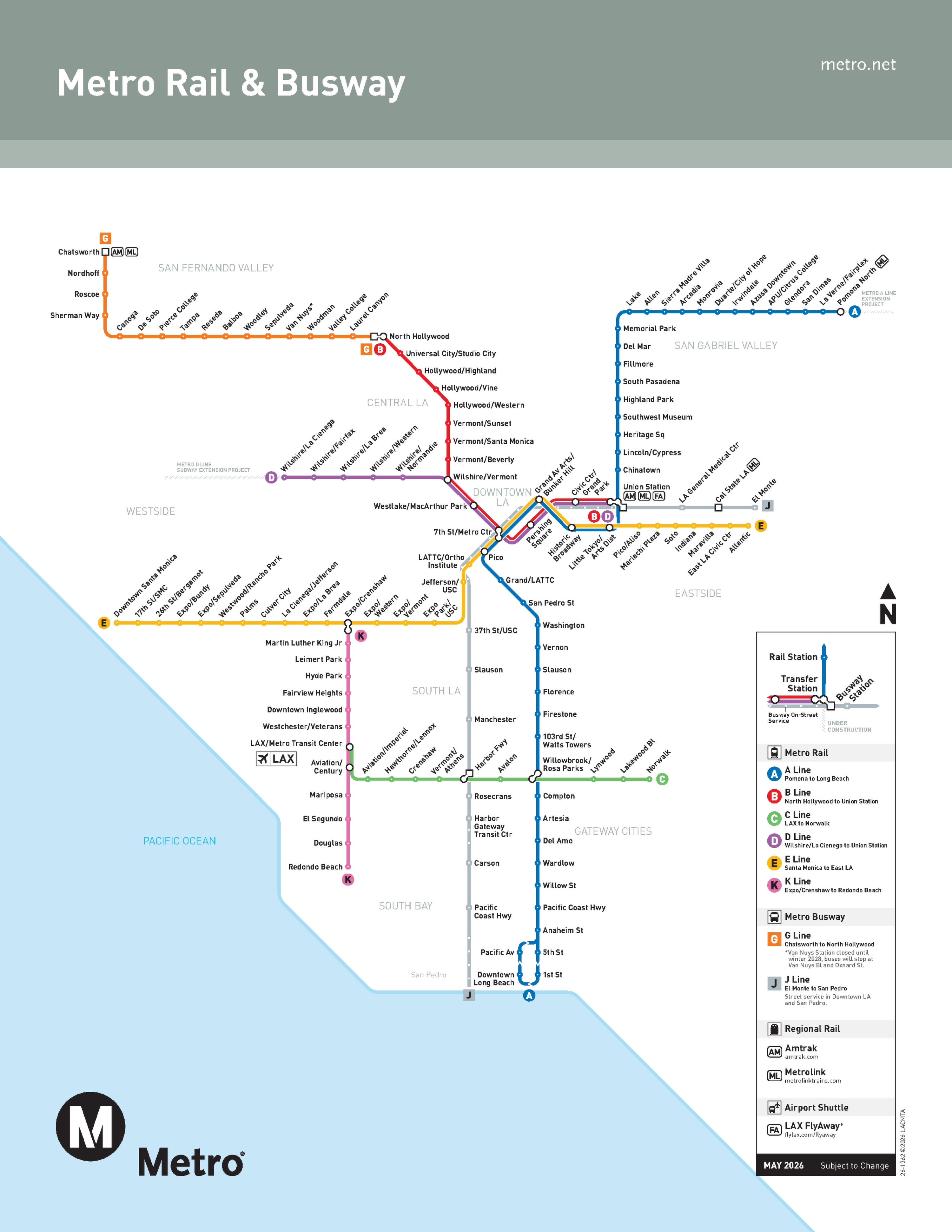
Los Angeles built its reputation on the car, yet its rail network now ranks among the busiest in the United States by ridership: Metro logged more than 311 million total boardings in 2024, up 8 percent on the year, and its reconfigured A and E Lines alone grew 33.4 percent between December 2023 and December 2024. The A Line, running from Pomona to Long Beach, is today the world’s longest light-rail line at about 57.6 miles.
The direct answer for reading the map: the LA Metro map combines two heavy-rail subway lines, four light-rail lines and two busways under one operator. That operator is the Los Angeles County Metropolitan Transportation Authority (LACMTA), branded simply as Metro, and the network is officially titled “Metro Rail & Busway”. Systemwide, Metro carries close to one million boardings a day across rail and bus.
The map covers roughly 125 miles (about 200 km) of route and more than 100 stations as of the 2025 reference year, with three Wilshire stations added when D Line Section 1 opened on 8 May 2026. The modern Metro Rail system dates to around 1990.
Two changes explain today’s map. The Regional Connector opened on 16 June 2023, a 1.9-mile downtown tunnel with three new stations that merged the former Blue, Expo and Gold Lines into today’s A and E Lines and created one-seat rides across the county. Because of the connector, the principal four-line interchange is now 7th St/Metro Center (A, B, D and E), while Union Station is served by the B and D Lines only. The old color names Blue, Expo and Gold are historical aliases; every current line is lettered.
The map also shows the G and J Lines. These are bus rapid transit busways, not trains, and appear as busway context so you can plan transfers without mistaking them for rail.
The table below explains the three service types on the map so visitors never confuse a subway, a light-rail line and a busway.
| Service type | Current lines | How it appears on the map | What visitors should know |
|---|---|---|---|
| Heavy-rail subway | B Line, D Line | Solid red and purple lines, mostly underground | Fully grade-separated trains; the quickest way across central Los Angeles and into Hollywood |
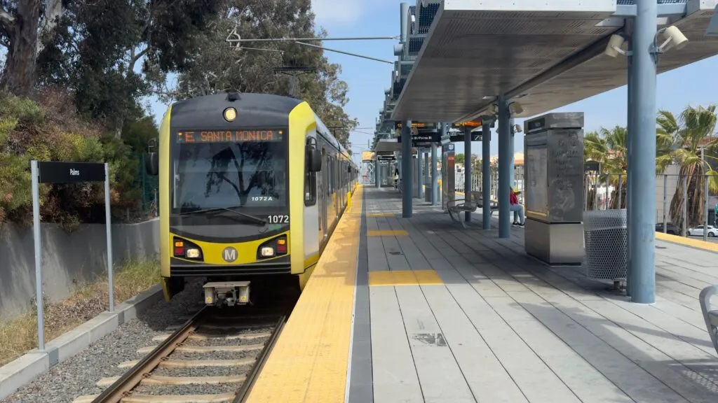
| Light rail | A, C, E, K Lines | Blue, green, yellow and pink rail lines | A mix of street-level, elevated and tunnel sections; longer end-to-end trips but the widest reach |
| Busway (BRT) | G Line, J Line | Shown as busway context, not as rail | High-frequency buses, not trains; useful connections but not part of Metro Rail |
Download the official map, find your nearest station and line, then use Metro’s trip planner for real-time routing. The rail network reaches several major visitor districts, but it does not make every Los Angeles trip rail-only, so expect a short walk, a shuttle or a bus at either end.
Los Angeles welcomed about 49.1 million visitors in 2023, the latest confirmed annual figure from the Los Angeles Tourism & Convention Board, and many of the city’s headline sights sit within a short walk of a rail station. Read the map by color and letter, plan your transfer at a labeled interchange such as 7th St/Metro Center, and confirm live times in the trip planner before you set out.
On safety, treat the Metro like any big-city transit system: stay aware, keep valuables close and use the official reporting channels rather than relying on blanket assurances. Metro runs a multilayered safety program with Transit Ambassadors, contracted Security Officers, law enforcement and 30,335 cameras, and its May 2026 dashboard recorded 133,614 customer assists and 19,277 fare checks.
You can report a concern through the Transit Watch app, by calling 1.888.950.7233, by texting 213.788.2777, or by dialing 911 in an emergency. At night, remember that Metro Rail does not run overnight; the OWL night bus network covers roughly 12 a.m. to 4 a.m. at least hourly.
| Destination | Line | Station | Practical note |
|---|---|---|---|
| Downtown Santa Monica (pier and beach) | E Line | Downtown Santa Monica | Western terminus; a few minutes' walk to the pier |
| Hollywood Walk of Fame | B Line | Hollywood/Highland | Steps from the Walk of Fame and TCL Chinese Theatre |
| Universal Studios Hollywood | B Line | Universal/Studio City | Free park shuttle every 10 to 15 minutes up the hill |
| The Broad and Walt Disney Concert Hall | A Line / E Line | Grand Av Arts/Bunker Hill | Short walk across Bunker Hill to both venues |
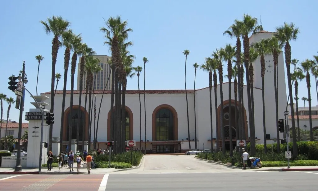
| Union Station and Olvera Street | B Line / D Line | Union Station | Served by B and D only; Olvera Street is opposite the station |
| Exposition Park museums and USC | E Line | Expo Park/USC | At the park entrance for the museums and the university |
| Crypto.com Arena and L.A. Live | A Line / E Line | Pico | About one block to the arena and L.A. Live |
| Los Angeles International Airport (LAX) | C Line / K Line | LAX/Metro Transit Center | Then the free LAX Metro Connector Shuttle to the terminals (People Mover not yet in passenger service) |
Yes, the Metro reaches Los Angeles International Airport, but not with a direct train into the terminals yet. As of July 2026 the Automated People Mover (SkyLink) is still in testing and not open to passengers, so the current journey uses a free shuttle plus a light-rail line:
When the People Mover opens, it is planned to link the LAX/Metro Transit Center directly to the terminals, but no passenger-service date is confirmed, so plan around the shuttle for now.
A single Metro ride costs a flat USD 1.75 regardless of distance, and when you tap the same card again within two hours the transfer is free. There is no separate day pass to buy: instead, fare capping is automatic, so you never pay more than USD 5 in a calendar day or USD 18 across a rolling 7-day period, with no registration required. Paid rides count toward the caps; free transfers do not. All prices are current as of July 2026.
| Ticket | Price | Buy ticket |
|---|---|---|
| Regular one-way fare | USD 1.75 | Tap a TAP card, the TAP LA app or a contactless bank card at the validator |
| Daily fare cap | Maximum USD 5 per calendar day | Automatic once you reach the cap; nothing to buy |
| Weekly fare cap | Maximum USD 18 per 7-day period | Automatic; no sign-up required |
| Physical TAP card | USD 2 plus stored value | Station vending machines and official channels at taptogo.net |
| TAP LA app (virtual card) | Free app; load stored value | TAP LA on the App Store and TAP LA on Google Play (publisher LACMTA) |
To pay, you have three main options. Buy a physical TAP card for USD 2 from a station vending machine and load stored value onto it; use the TAP LA app (published by LACMTA) to carry a virtual card and pay with your phone; or, since 28 May 2026, simply tap a contactless bank card or mobile wallet at the validator. Supported networks include Visa, Mastercard, American Express, Discover, JCB and UnionPay, plus Apple Pay and Google Pay, and one bank card can cover the holder and up to four companions who travel together. Reduced fares by bank card are not planned until a 2027 rollout, so eligible riders should still use TAP for now. Cash is accepted only on buses, in exact amount, and does not earn fare caps.
Ordinary visitors pay the regular fare; free and reduced travel is limited to named programs. Students at participating schools with an activated GoPass ride free; seniors 62 and over and riders with disabilities pay reduced fares and caps with a qualifying status; the LIFE program is limited to eligible Los Angeles County residents; and up to two children under 5 ride free with each paying adult. Free two-hour transfers are not the same as a free ride.
Service hours and frequency vary by line, so it is safer to check each line than to assume one network-wide window.
The table below is built from the current official timetables (most effective 7 June 2026; the E Line timetable is effective 14 December 2025). Link out to the official schedules at metro.net/riding/schedules rather than memorizing a full timetable, and recheck advisories for late trips.
| Line | Typical service span | Daytime frequency | Late or weekend note |
|---|---|---|---|
| A Line | About 4:00 a.m. to 11:45 p.m. | Roughly every 8 minutes at peak and midday | Weekends and holidays about every 10 to 12 minutes midday; possible delays after 8 p.m. |
| B Line | About 4:10 a.m. to 12:15 a.m. | About every 5 minutes at peak on the shared trunk (near 10 minutes per branch) | Minor maintenance delays after 9 p.m. |
| C Line | About 4:00 a.m. to 12:20 a.m. | Roughly every 13 minutes on weekdays | Evenings and weekends about every 20 minutes; trips may run up to 2 minutes early or late |
| D Line | About 4:10 a.m. to 12:15 a.m. | About every 5 minutes at peak on the shared trunk (near 10 minutes per branch) | Minor maintenance delays after 9 p.m. |
| E Line | About 3:45 a.m. to 12:15 a.m. | Roughly every 8 minutes at peak and midday | Possible delays after 8 p.m. |
| K Line | About 3:50 a.m. to 12:15 a.m. | Roughly every 12 to 13 minutes on weekdays | Weekends about every 20 minutes; minor delays after 9 p.m. |
The B and D Lines share a downtown trunk, so combined frequency there is higher than the per-branch figures suggest.
After about 8 to 9 p.m., planned maintenance can add delays on several lines, and overnight there is no rail: use the OWL night bus network between roughly 12 a.m. and 4 a.m.
Treat the Metro as you would any large urban transit system: it is neither guaranteed safe nor uniquely dangerous, and sensible habits matter most. By day the lines to the main tourist districts are busy and well-staffed; at night, ridership thins and rail service ends before the small hours, so plan your return with the OWL night bus or another option.
Metro’s layered program (Ambassadors, Security Officers, law enforcement and 30,335 cameras) is visible across the network, and you can report anything of concern through the Transit Watch app, by calling 1.888.950.7233, by texting 213.788.2777, or via 911 in an emergency.
Only one project changed the rail map in 2026, so separate what is open from what is still being built. Open: D Line Section 1 began regular service on 8 May 2026, adding three underground stations (Wilshire/La Brea, Wilshire/Fairfax and La Cienega) and extending the purple subway west; the LAX/Metro Transit Center has also been open since 6 June 2025.
Under construction: D Line Sections 2 (Wilshire/Rodeo and Century City/Constellation) and 3 (Westwood/UCLA and Westwood/VA Hospital) are being built toward an official 2027 target, though dates may shift. The East San Fernando Valley Line, a 6.7-mile light-rail line with 11 stations along Van Nuys Boulevard, is in major construction with a projected 2031 completion.
In testing but not yet open to passengers: the LAX Automated People Mover. A target date is never proof of operation, so until it carries passengers, the free shuttle connection above remains the way to reach the terminals.
Fun Fact: Metro runs an award-winning public-art program of original, site-specific artwork installed at stations across the network, in place since the late 1980s, so many stops double as small galleries you pass through on the way to the platform.
You might also be interested in these metro maps – for comparison or for your next trip:
Yes. The B Line (red) and D Line (purple) are true heavy-rail subway lines, running mostly underground. They sit inside a broader Metro Rail network that also includes the A, C, E and K light-rail lines, which mix underground, elevated and street-level track.
Yes, but not everywhere. The underground heavy-rail lines are the B and D Lines through Hollywood, Downtown and the Wilshire corridor. The rest of the Metro Rail network is light rail that runs partly on the surface and on elevated sections, so the whole system is not underground.
Ordinarily no: the standard fare is USD 1.75 per ride. Free travel is limited to named programs, such as students at participating schools with an activated GoPass, and up to two children under 5 with each paying adult. Seniors 62 and over and riders with disabilities pay reduced fares. A free two-hour transfer between rides is not the same as a free ride.
Yes, with one connection as of July 2026. The Automated People Mover is not yet in passenger service, so take the free LAX Metro Connector Shuttle from any terminal to the LAX/Metro Transit Center, then the C or K Line. For Downtown, ride the K Line to Expo/Crenshaw and transfer to the E Line, roughly 45 to 55 minutes in total.
Yes, two official ones, both published by LACMTA. The TAP LA app carries a virtual TAP card and lets you pay fares from your phone. The separate “LA Metro – Official” app handles trip planning, arrival times and service alerts, but it does not yet process fare payments. Download only from the official app stores.